
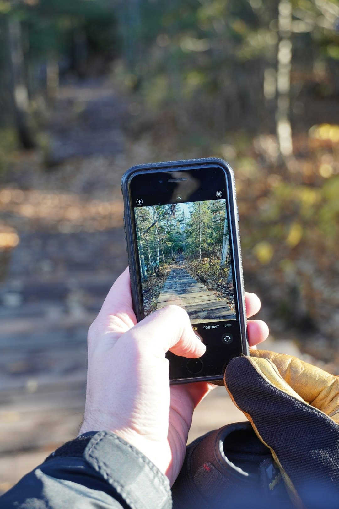
Track every route beyond the road
SageRide is built for cycling, trail running, hiking, and high-mountain adventures — with GPS tracking, elevation data, and offline route support when the terrain gets remote.
Built for remote terrain where your watch, signal, and certainty run out.
Sage Ride
Your ultimate companion for cycling adventures. Track, analyze, and share your rides with precision.
Download on the App Store AppleInstall on the App Store

Install on the Google Play


Track Every Ride
Record your cycling adventures with precision GPS tracking and detailed metrics
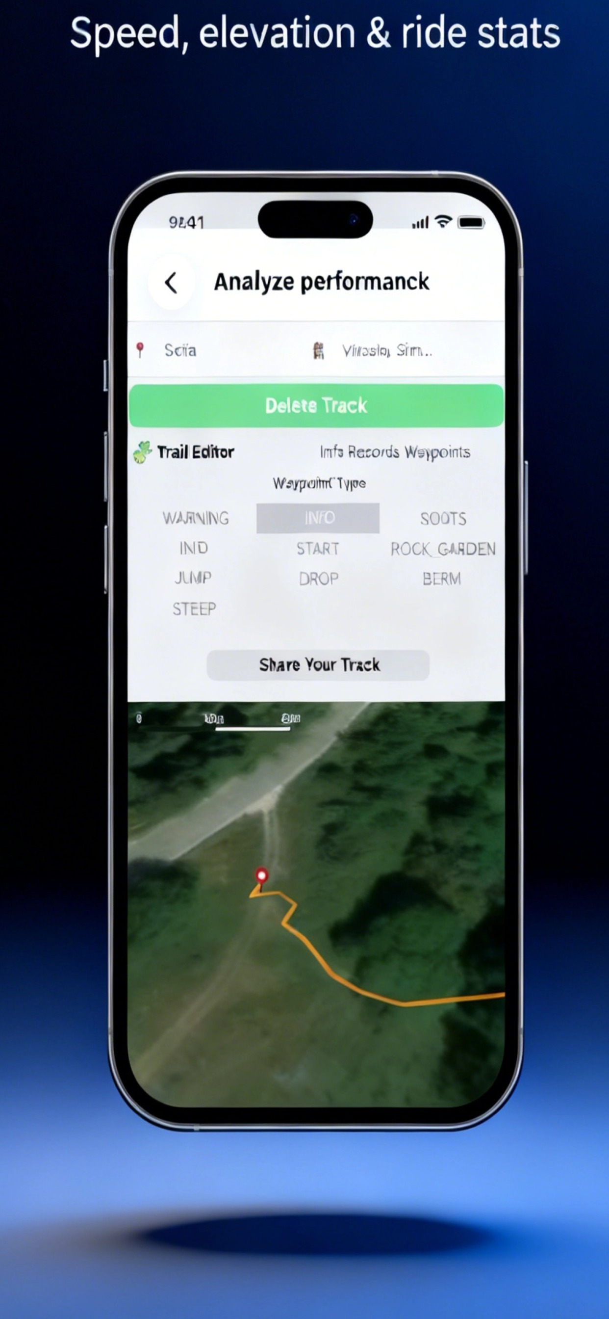
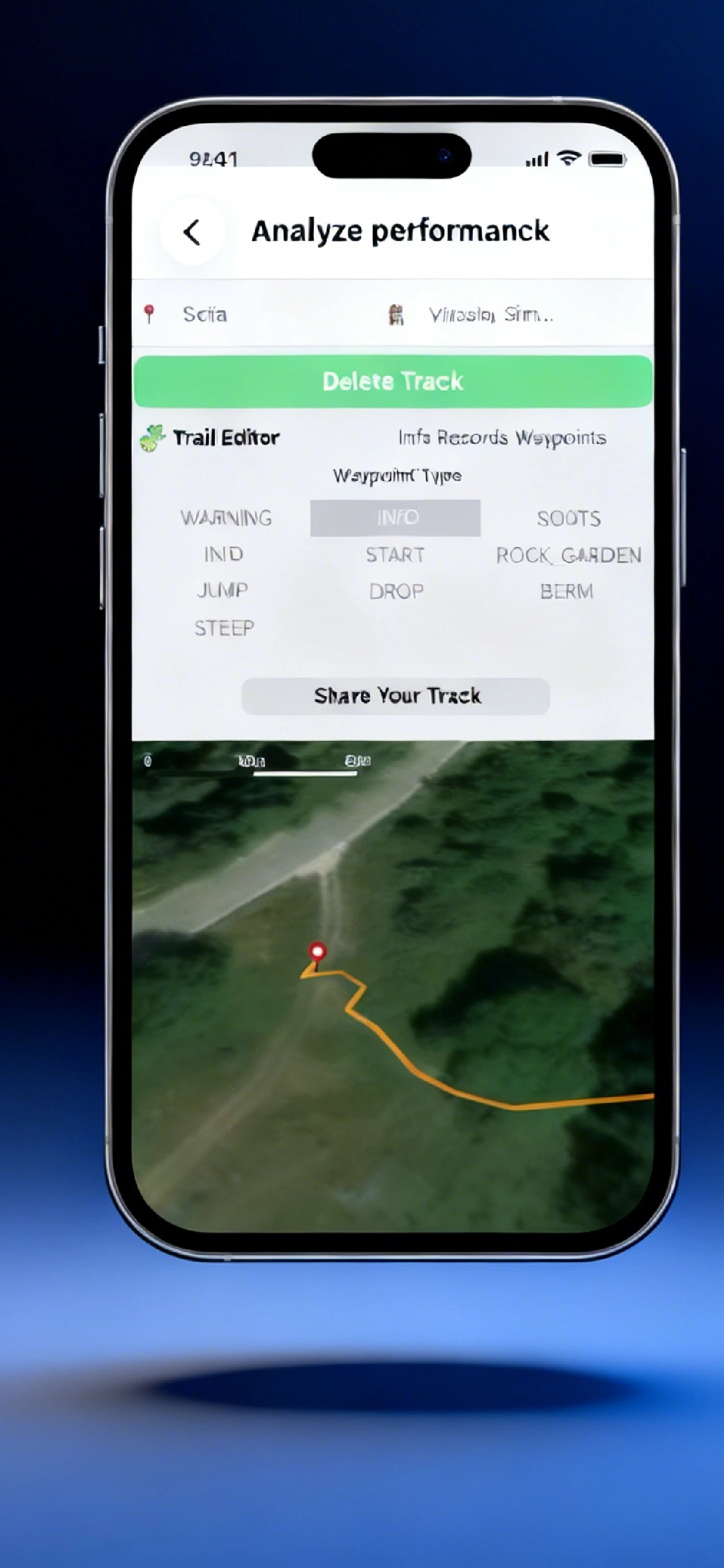
Analyze Performance
Deep insights into your cycling performance with comprehensive analytics
Custom Routes
Create and customize routes tailored to your cycling preferences

Offline Maps
Navigate anywhere with offline maps - no internet connection required
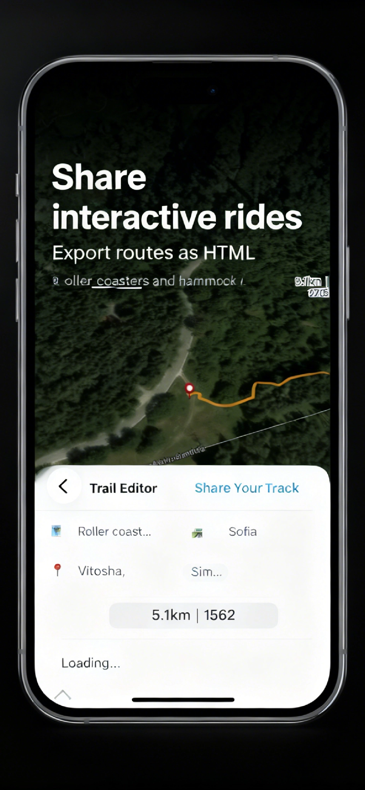
Share Rides
Share your cycling achievements with friends and the community
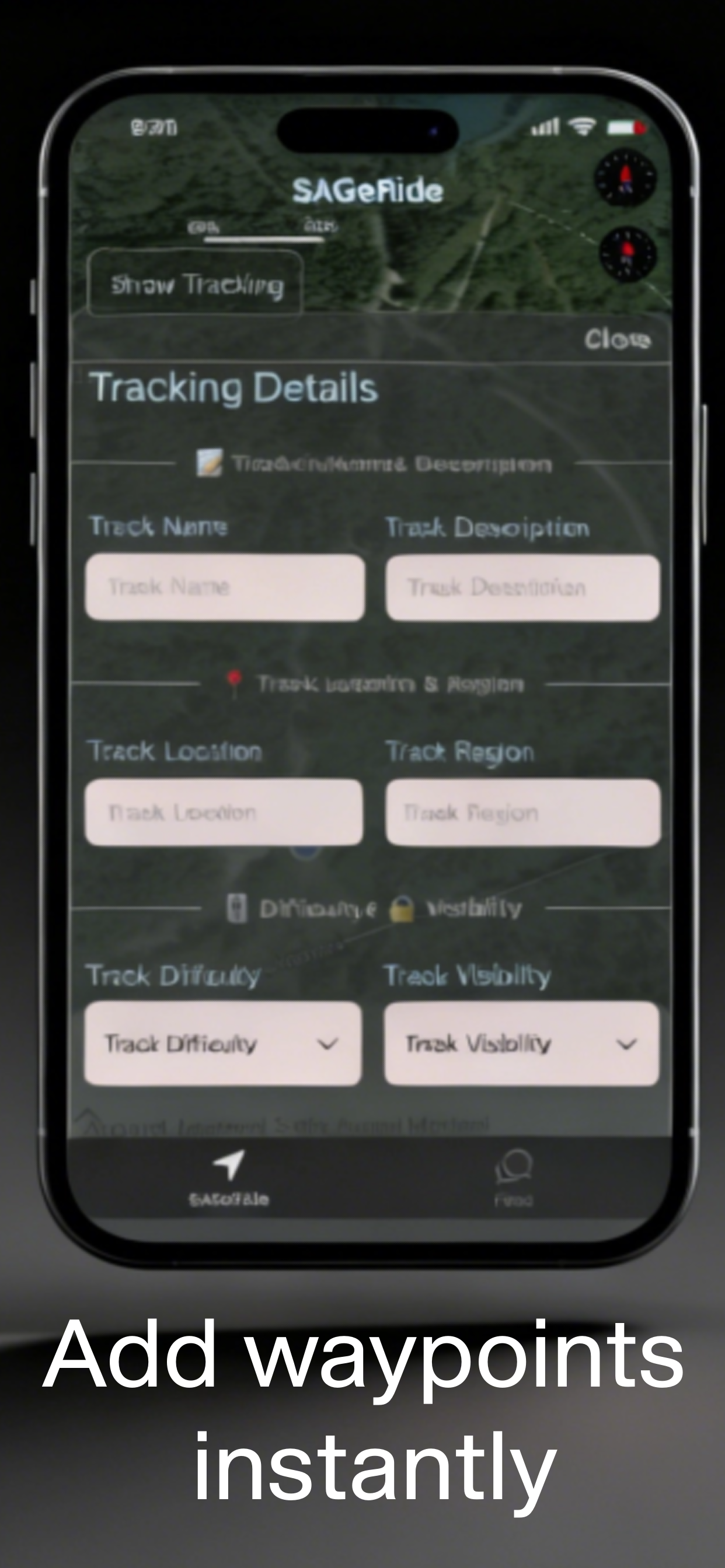
Embed Routes
Embed your favorite routes and share them across platforms

Built for Adventure
Designed for cyclists who live for the open road and new challenges
See every kilometer in detail
Understand every detail of your ride
Navigate with confidence
Record every climb, track every descent, and keep your route history wherever the trail takes you
GPS Route Recording
Precise GPS tracking captures every turn, switchback, and summit. Export GPX files or review your path in-app.
Elevation Gain & Descent
Real-time altitude tracking with detailed elevation profiles. Know your climb metrics before, during, and after.
Offline Maps & Navigation
Download maps ahead of time. Navigate confidently in remote areas where cell signal doesn't reach.
Time, Pace & Distance
Track duration, average pace, moving time, and total distance. Compare performance across routes and activities.
Battery-Safe Tracking
Optimized GPS recording extends battery life on all-day adventures. No need to carry a backup device.
Saved Routes Library
Build your personal collection of cycling, running, and hiking routes. Revisit favorites or discover new paths.
Built for every outdoor adventure
From mountain peaks to forest trails, SageRide adapts to your activity
Cycling
Road rides, gravel routes, and mountain trails — track speed, cadence, and elevation.

Trail Running
Technical terrain demands precise tracking. Monitor pace, vertical gain, and effort zones.

Hiking
Multi-day treks or day hikes — save waypoints, track progress, and navigate safely back.

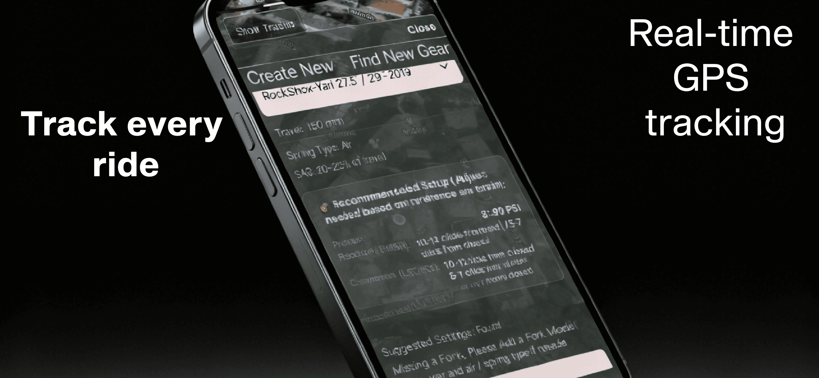
SageRide
AI-Powered MTB Suspension Analytics
Real-time telemetry, smart tuning recommendations, and performance tracking for the modern mountain biker
Advanced Suspension Intelligence
Professional-grade telemetry and AI-powered tuning for Fox and RockShox suspension systems

Suspension Telemetry

Performance Metrics

Smart Tuning

Group Tracking
Real-Time Data
1000Hz sensor sampling captures every compression, rebound, and impact with millisecond precision.
AI Tuning
Machine learning algorithms analyze your riding style and terrain to recommend optimal suspension settings.
Performance Analytics
Track improvement over time with detailed metrics on speed, elevation, technique, and equipment efficiency.

Discover & Mark Trails
Create, share, and track your favorite MTB routes with GPS precision and community insights
Public Trails
Discover community-shared MTB routes with GPS coordinates, elevation profiles, and rider reviews.
Private Trails
Keep your secret spots safe. Mark personal tracks visible only to you or invited riders.
Builder Profiles
Track trail construction, log maintenance, and celebrate builders with detailed project histories.
GPS Precision & Elevation
High-accuracy GPS tracking with detailed elevation profiles showing climbs, descents, and technical sections.
Live Trail Status
Real-time updates on trail conditions, weather impacts, and closure notifications from the community.
Essential Gear
Premium accessories for the modern mountain biker
Quad Lock Out Front Mount
Professional-grade handlebar mount with integrated vibration dampening and secure quick-release mechanism. Built for aggressive trail riding.
Glass-filled nylon
+ Stainless steel
22 / 25.4 / 31.8 / 35mm
4 spacers included
65g
Ultra-lightweight
Integrated rubber
Vibration dampener
Visual Design
Black anodized CNC aluminum accents
Premium machined finish
Blue lock lever (signature Quad Lock)
Quick-release mechanism
Clean cable routing through mount arm
Organized handlebar setup
Secure Lock
Dual-stage locking prevents accidental release on rough terrain
Quick Install
Tool-free installation in under 60 seconds with universal compatibility
Adjustable Angle
360° rotation for perfect viewing angle in any riding position
Preventing Crashes, Not Just Tracking Rides
SageRide's vibration AI predicts accidents before they happen, analyzing real-time data to alert riders of dangerous conditions.
Crash prediction accuracy
Average warning time
Real-time vibration analysis
AI detects dangerous terrain patterns
Proactive crash alerts
Warns riders before dangerous situations
Impact severity detection
Emergency contacts notified automatically
Live Vibration Analysis

Live Rider Positions
Connecting Drivers and Cyclists Through Data Empathy
Live rider positions visible to all road users. SageRide creates mutual awareness that prevents accidents through technology, not conflict.
Real-time positioning
Drivers see cyclists approaching blind corners and intersections
Speed & direction data
Predictive collision warnings for both cyclists and drivers
Privacy-first sharing
Anonymous positioning data, no personal information exposed
Technology that builds empathy between road users, not walls.
500K Riders Reducing Car Dependency
Phone sensors, no extra hardware. SageRide makes MTB technology accessible to everyone in Central & Eastern Europe.

Active Riders
CEE region
Hardware Cost
Just your phone
CO₂ Reduction
vs. car usage
Phone Sensors
Accelerometer, GPS, gyroscope - everything you need
Affordable
No expensive sensors or subscription fees
Eco-Friendly
Zero e-waste from specialized devices
Community
500K riders across CEE sharing the roads
Trail Data Powers Real Infrastructure Changes
Golden Dust Bike Park and Zlatica municipalities use SageRide data to improve bike infrastructure based on actual rider behavior.
Golden Dust Trail Network
COMPLETED12km of new bike lanes based on rider heat map data
Zlatitsa Mountain Routes
IN PROGRESSTrail maintenance prioritized by usage analytics
Municipal partnerships
Infrastructure investment

Trail Usage Analytics
Real rider data informing municipal trail development

Trail Usage Analytics
14 miles total | 5,705ft descent | Data from Vivo Club & local riders(Dimitar Mazneikov)
Petrich Trails - Freeride Paradise
World-class freeride destination maintained by Teodor Mavrudiev - Bulgaria's most successful freerider. Home of Vivo Club and organizer of Petrich DHI race. SageRide tracks real rider data across 13 trails.
Petrich Trail Network
ESTABLISHED13 mountain bike trails across Belasitsa mountain
Vivo Club Petrich
ACTIVEOrganizers of Petrich DHI & Enduro races. Teodor Mavrudiev - 2017 DHI winner
Trails maintained
Riders tracked
No Blame, Just Awareness
Technology uniting road users through crash prediction and live positioning. SageRide replaces conflict with connection.

Safer Roads Through Understanding
Live Alerts
Both parties warned before conflicts
Visibility
See each other before it's too late
Empathy
Data builds mutual respect
Cyclist-Driver Incidents
In pilot regions using SageRide awareness system
User Satisfaction
Riders feel safer sharing roads with aware drivers
Connected Road Users
Growing network of aware cyclists and drivers
This isn't about who's right or wrong. It's about getting everyone home safely.
— SageRide Safety Mission

HOTALICH
CYCLING CLUB
Official SageRide Partner
Proud to partner with Hotalich Cycling Club — Bulgaria's premier mountain biking community.
Our club members are the first penetration testers for SageRide Beta, pushing the limits of MTB analytics on Bulgaria's most challenging trails.
DOWNLOAD BETA
Ready to Upgrade Your Ride?
Join thousands of riders using SageRide to optimize their MTB suspension and performance
Powered by enterprise-grade infrastructure & core integrations